

Monument Valley spans 91,696 acres of the Colorado Plateau across the Utah-Arizona border. Massive sandstone buttes rise 1,000 feet above the desert floor, protected within a sovereign Navajo Tribal Park.
Massive sandstone buttes dominate 91,696 acres of the Colorado Plateau along the Utah-Arizona border. Monument Valley is not a U.S. National Park. The Navajo Nation owns and manages this land as a sovereign Tribal Park, charging a $15 per person entry fee and a $20 vehicle fee. National Park passes hold no value at the entrance gate. Summer temperatures routinely exceed 100°F. Visitors drive a 17-mile unpaved loop road consisting of rough dirt, gravel, and deep sand dunes. Low-clearance sedans risk severe undercarriage damage, making high-clearance SUVs or guided jeep tours the safer choices. The park prohibits drones, RVs, camper vans, motorcycles, and large off-road vehicles on the scenic drive.
The valley floor sits between 5,000 and 6,000 feet above sea level. Iron oxide in the weathered Cutler Group siltstone gives the landscape its vivid red coloration. Dark blue-gray streaks of manganese oxide run down the sheer cliff faces. Passing clouds cast sharp, fast-moving shadows across the desert floor. Wind whips fine red sand through the air, coating vehicles and camera lenses. Travelers typically spend three hours navigating the scenic loop, stopping at designated pullouts. The route passes iconic formations like the Mittens, Merrick Butte, and John Ford's Point. Children often enjoy identifying uniquely shaped rocks like the Elephant and the Camel along the drive.
Backcountry access requires hiring a licensed Navajo guide. Heavy monsoon rains from July through September frequently wash out the dirt roads, forcing sudden park closures. Check the official Navajo Nation Parks site for daily road conditions before making the 195-kilometer, two-hour drive from Page, Arizona, or the 224-kilometer drive from Cortez, Colorado. Driving from Moab, Utah takes about two hours and thirty-eight minutes heading south on Highway 191 and Highway 163. The Visitor Center terrace provides a fully paved, wheelchair-accessible platform overlooking the valley. Older travelers and those with mobility limitations can view the 1,000-foot monoliths directly from this vantage point without navigating the rugged terrain below. Bring a warm down jacket for sunrise tours, as high desert temperatures drop below freezing during winter nights and spring mornings. Wear closed-toe tennis shoes, long sleeves, and a wide-brimmed hat to protect against the intense sun and blowing sand.
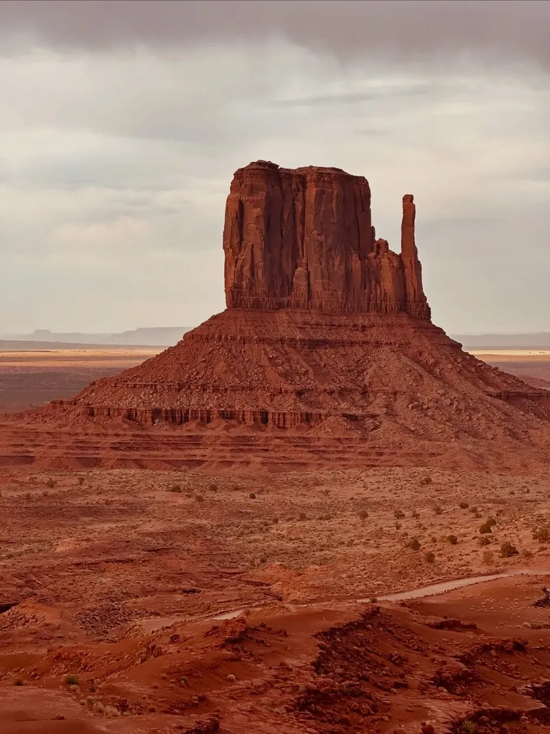
Ice Age Paleo-Indian hunters first tracked game across this high desert landscape. Anasazi farmers followed around 1200 B.C., cultivating the arid soil and carving petroglyphs into the canyon walls that remain visible today. President Chester Arthur officially transferred the region into the Navajo Reservation in 1884. The federal government recognized Navajo sovereignty over the land, cementing the tribe's control over the valley's resources.
Harry Goulding established a trading post on the valley's edge in 1924. He traded goods with local Navajo families and recognized the commercial potential of the striking geology. Goulding traveled to Hollywood in 1938 with photographs of the towering buttes, pitching the location to film director John Ford. Ford chose the valley for his film "Stagecoach," instantly transforming the remote desert into a global symbol of the American West. Production crews poured into the area over the next two decades. The influx of movie studios brought paved roads and steady income to the isolated region. John Ford's Point, a prominent overlook in the park, bears the director's name and serves as the exact spot where the famous "Man on a Horse" photograph was taken.
The Navajo Tribal Council established the Monument Valley Tribal Park in 1958. Tribal leaders saw the need to protect their sacred sites from unregulated tourism and resource exploitation. The designation created a formal boundary of 91,696 acres, implementing strict rules against off-trail hiking and unauthorized commercial photography. Commercial filming, weddings, and portrait sessions now require a Special Use Permit obtained directly from the Visitor Center.
Modern infrastructure remains intentionally limited to preserve the landscape. The View Hotel, built directly on the canyon rim, provides the only lodging inside the park boundaries. Tribal authorities maintain the 17-mile loop as a dirt road to limit traffic speeds and preserve the rugged character of the environment. Visitors walking the 3.2-mile Wildcat Trail retrace the exact routes Navajo shepherds have used for centuries. The nearby Goulding's Trading Post operates today as a museum. Exhibits display the original photographs used to pitch the valley to Hollywood directors, alongside traditional Navajo pottery and historical family mementos. Just 15 to 20 minutes north of the park entrance, Highway 163 cuts straight toward the distant buttes. This specific stretch of asphalt gained fame as the location where a famous movie character ended his cross-country run, drawing photographers daily. Assign a lookout to watch for fast-moving oncoming traffic when taking photos on this active highway.

Three distinct geological layers form the 1,000-foot sandstone buttes rising from the valley floor. Organ Rock shale provides the wide, sloping bases of the monuments. De Chelly sandstone creates the sheer, vertical cliffs in the middle section. Moenkopi shale caps the flat tops of the mesas, protecting the softer rock below from rapid erosion. Millions of years of wind and water peeled away the surrounding plateau, leaving only these isolated monoliths behind.
The Totem Pole stands as the most fragile formation in the park. This narrow sandstone spire rises sharply from the desert floor, sculpted by centuries of blowing sand. Visitors driving the 17-mile loop view it from a distance, as the structure is highly unstable and off-limits to climbers. The West and East Mitten Buttes dominate the northern end of the valley. Their distinct thumb-like spires point skyward, creating massive silhouettes against the horizon. John Ford's Point offers a panoramic look at the vast desert landscape. Steep drop-offs surround the viewing area, requiring parents to keep children close as there are no safety railings installed.
Twice a year, the Mitten Shadow event alters the landscape. In late March and mid-September, the setting sun aligns the shadow of West Mitten Butte perfectly over East Mitten Butte. Photographers crowd the Visitor Center terrace hours in advance to capture the alignment. Flash floods reshape the valley floor during the July to September monsoon season. Violent afternoon thunderstorms dump inches of rain in minutes, turning dry washes into rushing rivers of red mud that block the scenic drive. Drivers must monitor local weather forecasts before entering the valley loop, as vehicles easily become trapped in the deep, wet sand.
Nearby geological sites share similar characteristics. Valley of the Gods sits 45 minutes away, featuring a 17-mile dirt road winding through miniature sandstone formations managed by the Bureau of Land Management. Goosenecks State Park, located under an hour from the valley, showcases the San Juan River carving tight loops through the rock. The river travels seven miles of twists and turns while advancing less than two miles as the crow flies. The Artist's Point overlook sits at the far end of the 17-mile loop road. Photographers gather here at sunrise to watch the eastern light illuminate the western faces of the buttes, casting a warm, golden glow over the entire valley.
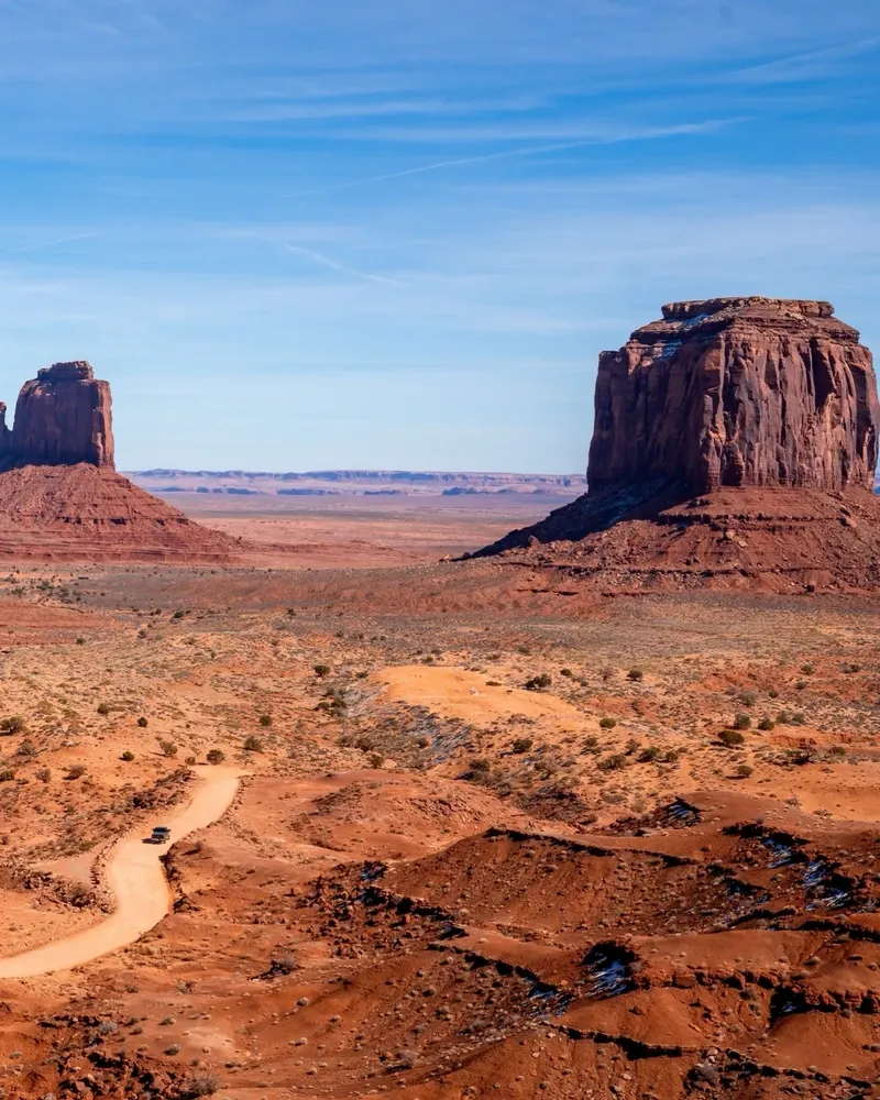
The Navajo Nation calls this land Tsé Biiʼ Ndzisgaii, translating to "the valley of the rocks." The towering buttes represent more than geological anomalies; they are sacred monuments holding the spirits of Navajo ancestors. Traditional stories identify the towering spires as ancient gods turned to stone. The Totem Pole formation specifically represents a deity held up by lightning.
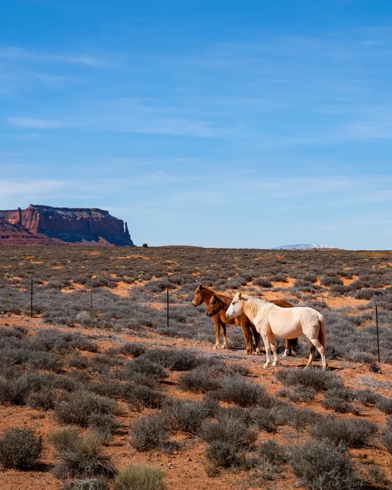
Navajo families maintain active homesteads on the valley floor. They herd sheep through the sagebrush and weave traditional wool rugs using techniques passed down through generations. The land sustains their pastoral way of life. Tourists driving the loop road pass near these private residences. Taking photographs of Navajo residents or their homes without explicit permission violates tribal privacy laws. Roadside stands operate along the loop road and near the Visitor Center. Purchasing authentic wool rugs or silver jewelry directly from these local artisans supports the community economy.
Access to specific sites requires hiring a licensed Navajo guide. Formations like the Ear of the Wind arch and Mystery Valley sit in restricted backcountry zones. Guides share oral histories and traditional songs beneath the sandstone arches, providing context that independent travelers miss. The Navajo Parks and Recreation Department strictly enforces these boundaries. Trespassing on federal Indian reservation land carries severe legal penalties. Visitors must secure a Backcountry Permit from the Visitor Center for any hiking outside the designated Wildcat Trail.
The cultural footprint extends beyond the park boundaries. The Four Corners Monument, managed by the Navajo Nation, sits 1.5 hours away. Visitors stand in Arizona, Utah, Colorado, and New Mexico simultaneously while browsing local vendor booths selling handmade crafts. Thirty minutes from the park, the small town of Mexican Hat takes its name from a rock formation resembling an overturned sombrero. The town serves as a base for rock climbers and adventure tours operating along the San Juan River. Winter hours for the scenic drive run from 8:00 am to 5:00 pm, while summer hours extend to 7:00 pm. The park closes entirely on Thanksgiving Day, Christmas Day, and New Year's Day.
Park officials strictly prohibit drones and will confiscate any flown within the 91,696-acre boundary.
Pets are banned from all Navajo Tribal Park locations, including the scenic drive and hiking trails.
Highway 163 north of the park is the exact filming location where the movie character ended his cross-country run.
In late March and mid-September, the shadow of West Mitten Butte perfectly covers East Mitten Butte at sunset.
The 3.2-mile Wildcat Trail is the only hike visitors can complete without hiring a licensed Navajo guide.
The buttes consist of Organ Rock shale at the base, de Chelly sandstone in the middle, and Moenkopi shale on top.
Monsoon rains from July through September create sudden flash floods that regularly wash out the 17-mile dirt loop road.
No, it is a Navajo Tribal Park established in 1958. The Navajo Nation manages the land as a sovereign territory.
America the Beautiful passes hold no value here. Visitors pay a $15 per person tribal entry fee and a $20 vehicle fee.
Standard sedans can navigate the dirt road in dry weather, but drivers risk undercarriage damage. High-clearance SUVs or guided jeep tours handle the deep sand and severe potholes much better.
Dogs are strictly prohibited at all Navajo Tribal Park locations. You cannot bring pets on the scenic drive or the hiking trails.
Drones are banned throughout the entire tribal park. Park officials will confiscate any drones flown within the boundaries to protect resident privacy.
The Wildcat Trail is a 3.2-mile self-guided loop hike circling West Mitten Butte. It is the only trail in the park that allows independent hiking without a Navajo guide.
The shadow of West Mitten Butte aligns perfectly with East Mitten Butte at sunset twice a year. This astronomical event peaks around March 30th and September 13th.
The View Hotel and Cabins operates as the only lodging facility inside the park boundaries. It provides rooms with private balconies facing the Mittens, plus tent sites and an RV park.
Independent off-road travel in the backcountry is illegal. You must book a guided tour with a licensed Navajo operator to see restricted areas like Mystery Valley or Hunts Mesa.
Late fall and early spring offer comfortable temperatures and smaller crowds. The peak summer season brings heat exceeding 100°F, while late summer monsoons cause dangerous flash floods.
Browse verified tours with free cancellation and instant confirmation.
Find Tours